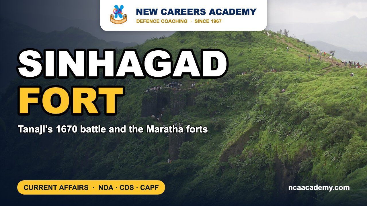
Quick answer: Sinhagad, earlier called Kondhana, is a Maratha hill fort in the Sahyadri range south-west of Pune, famous for Tanaji Malusare’s night assault of February 1670. It is in the news because the Pune Municipal Corporation has proposed a 100-foot saffron flag at the fort, with Rs 1 crore set aside, as reported on 1 November 2026.
Why Sinhagad Fort is in the news
According to the Free Press Journal (1 November 2026), Municipal Commissioner Naval Kishore Ram placed the proposal before the PMC Standing Committee. The project is part of the civic body’s 2026-27 budget, with Rs 100 lakh routed through the Building Department for the flagpole, beautification of the area and upkeep. Because the fort lies outside the corporation’s limits, Standing Committee chairman Srinath Bhimale said the plan also needs approval from the PMC general body under the Maharashtra Municipal Corporation Act. A spot in the MTDC tourist accommodation area was chosen after a site visit on 11 September.
Key facts about Sinhagad Fort
- Location: Perched on a lone spur of the Sahyadris known as the Bhuleswar range, roughly 25 to 30 km south-west of Pune, at about 1,300 m above sea level.
- Old name: Kondhana, linked to the sage Kaundinya.
- Gates: Two entrances, the Pune Darwaza (north-east) and the Kalyan Darwaza (south-east).
- View: On a clear day Rajgad, Torna and Purandar are visible, which made Kondhana a key link in the defence of the Pune region.
- Memorials: A memorial to Tanaji Malusare and the cenotaph of Chhatrapati Rajaram I, who died at the fort in 1700.
- Tilak link: Bal Gangadhar Tilak used a bungalow here as a summer retreat.
The Battle of Sinhagad, 1670
Under the Treaty of Purandar (1665) with the Mughal general Mirza Raja Jai Singh, Shivaji had to give up 23 forts, Kondhana among them. When the truce broke down, Kondhana was among the first forts he set out to recover. It was held by a Mughal garrison under Udaybhan Rathod.
Tanaji Malusare set out with his brother Suryaji and uncle Shelar. Mixing with local villagers in disguise, he collected information on the fort and found a weak point on its western cliff. On the night of 4 February 1670 a small party climbed it with rope ladders. The popular story of a monitor lizard (“ghorpad”) carrying the rope is most likely legend. Inside, the climbers headed for the Kalyan Darwaza. In close fighting Tanaji and Udaybhan both fell. Suryaji then rallied the men and opened the gate, letting the waiting Marathas in, and the fort fell by daybreak. Shivaji’s grief is remembered in the line “Gad ala, pan Sinha gela”, meaning “we have taken the fort but lost the lion”, and the fort became Sinhagad, the Lion’s Fort.
Aurangzeb took it again in 1703 and the Marathas recovered it in 1706. It passed to the East India Company during the Third Anglo-Maratha War (1817-18).
Maratha Military Landscapes on the UNESCO list
At its 47th session in July 2025 the World Heritage Committee inscribed the Maratha Military Landscapes of India under criteria (iv) and (vi), making it India’s 44th World Heritage property. It is a serial site of 12 forts built or expanded between the 17th and 19th centuries. Sinhagad is not one of the 12.
| Fort | State | Protected by |
|---|---|---|
| Salher | Maharashtra | State Archaeology |
| Shivneri | Maharashtra | ASI |
| Lohagad | Maharashtra | ASI |
| Khanderi | Maharashtra | State Archaeology |
| Raigad | Maharashtra | ASI |
| Rajgad | Maharashtra | State Archaeology |
| Pratapgad | Maharashtra | State Archaeology |
| Suvarnadurg | Maharashtra | ASI |
| Panhala | Maharashtra | ASI |
| Vijaydurg | Maharashtra | ASI |
| Sindhudurg | Maharashtra | ASI |
| Gingee | Tamil Nadu | ASI |
Military history angles for SSB lecturettes
- Reconnaissance first: Tanaji studied the ground and the garrison before committing troops, the same logic as modern pre-operation intelligence.
- Surprise and night action: A small force used darkness and an unexpected approach to beat a larger, well-placed defender.
- Continuity of command: When the leader fell, Suryaji took over at once and the mission did not collapse.
- Terrain as a force multiplier: The UNESCO listing itself credits the Marathas with fitting forts to the Sahyadri, Konkan and Deccan terrain.
Exam angle: how NDA, CDS and CAPF can ask this
- Questions may list forts and ask which is NOT part of the UNESCO Maratha site; Sinhagad is a likely distractor.
- Treaty of Purandar (1665) and the Third Anglo-Maratha War are staples of NDA and CDS history.
Practice MCQs
Q1. Sinhagad was earlier known as:
(a) Rajgad (b) Kondhana (c) Torna (d) Murumbdev
Answer: (b) — it was renamed after Tanaji’s death in 1670.
Q2. Which of the following is NOT among the 12 forts of the Maratha Military Landscapes World Heritage site?
(a) Sinhagad (b) Salher (c) Khanderi (d) Gingee
Answer: (a).
Q3. Kondhana passed to the Mughals under which treaty?
(a) Treaty of Salbai (b) Treaty of Purandar (c) Treaty of Bassein (d) Treaty of Surat
Answer: (b) — signed in 1665 with Mirza Raja Jai Singh.
Q4. The Mughal commander killed at Kondhana in February 1670 was:
(a) Shaista Khan (b) Afzal Khan (c) Udaybhan Rathod (d) Dilir Khan
Answer: (c).
Frequently asked questions
Where is Sinhagad Fort?
It stands on the Bhuleswar range of the Sahyadri hills, about 25 to 30 km south-west of Pune in Maharashtra.
Is Sinhagad a UNESCO World Heritage Site?
No. The 2025 Maratha Military Landscapes listing covers 12 forts, and Sinhagad is not among them.
Who captured Sinhagad in 1670?
Tanaji Malusare led the assault on the night of 4 February 1670; after he was killed, his brother Suryaji completed the capture.
Why is Sinhagad in the news in 2026?
The Pune Municipal Corporation has proposed a 100-foot saffron flag at the fort with Rs 1 crore in its 2026-27 budget, pending general body approval.
Also read on NCA: UNESCO Tentative List of India | Monthly defence current affairs PDFs | NDA coaching in Chandigarh
Sources: Free Press Journal, UNESCO World Heritage Committee decision 47 COM 8B.16, UN in India, The Week, Wikipedia. Facts as reported up to 2 November 2026.
Featured image background: SasmitV / Wikimedia Commons, CC BY 3.0.