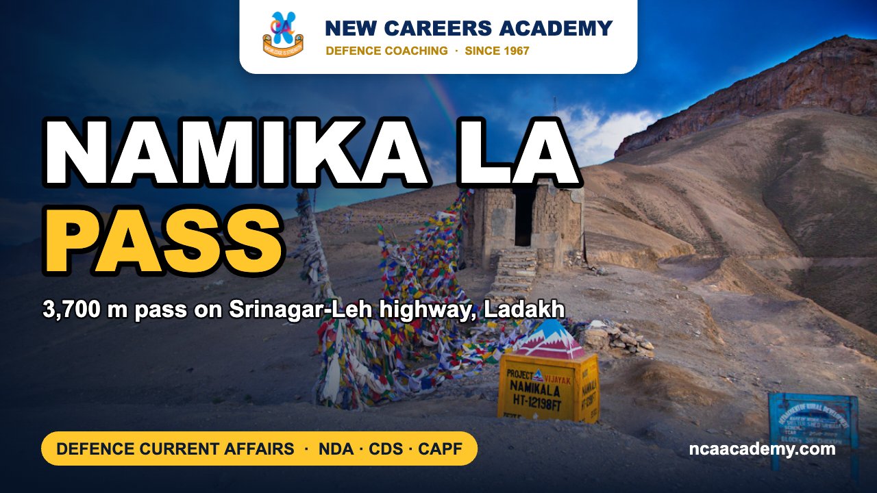
Quick answer: Namika La is a mountain pass about 3,700 metres high in the Zanskar Range of Ladakh, on the Srinagar–Leh highway (NH-1) between Kargil and Leh. It was in the news after two Indian Army personnel lost their lives in a road accident near the pass on 4 November 2026.
Why Namika La Pass is in the news
On the afternoon of Wednesday, 4 November 2026, an Indian Army heavy-duty vehicle went off the road into a gorge near Namika La on the Kargil–Leh National Highway. Officials quoted by the news agency IANS said the driver and co-driver, both Army personnel, died at the site. Police Station Wakha has registered a case under the Bharatiya Nyaya Sanhita, and the cause of the accident is under investigation. The personnel had not been officially named in the reports available. We offer our condolences to their families and units.
The accident is a reminder of how hard it is to keep troops supplied on Ladakh’s roads, where steep gradients, sharp bends and harsh weather are routine.
Key facts about Namika La
- Location: Union Territory of Ladakh, on the stretch of road between Kargil and Leh.
- Altitude: about 3,700 metres (12,139 feet) above sea level.
- Mountain range: the Zanskar Range of the Himalayas.
- Meaning: the name is usually translated as “Pillar of the Sky” pass.
- Road: crossed by the Srinagar–Leh highway (NH-1), roughly 54 km from Kargil and 105 km from Leh, according to IANS.
- Approaches: on the west, the road climbs from the Wakha Rong valley above Mulbekh. On the east, it descends towards the Sangeluma valley near Bodh Kharbu.
- Twin pass: Namika La is one of two high passes between Kargil and Leh. The other is the higher Fotu La.
Namika La and Fotu La on the Srinagar–Leh road
From Srinagar, the highway first crosses Zoji La, which links the Kashmir Valley with the Dras and Suru valleys of Kargil district. Beyond Kargil it rises over Namika La and then over Fotu La. At about 4,108 metres (13,478 feet), Fotu La is the highest point on the Srinagar–Leh highway, higher than Zoji La. East of Fotu La the road drops towards Lamayuru on its way to Leh.
Zoji La is often blocked by snow in winter, though the Border Roads Organisation tries to keep it open. India is building an all-weather Zoji-la Tunnel, about 14 km long, to keep the road open through the year. Zoji La also has a place in military history: in Operation Bison on 1 November 1948, Indian troops recaptured the pass with tanks, which were then operating at a record altitude for armour in combat.
Other important passes of Ladakh
| Pass | Approx. height | Range / route | What it connects |
|---|---|---|---|
| Zoji La | Lower than Fotu La | Srinagar–Leh highway (NH-1) | Kashmir Valley (Ganderbal) with Dras–Suru valleys (Kargil) |
| Namika La | 3,700 m | Zanskar Range; NH-1 | Mulbekh side with Bodh Kharbu side, between Kargil and Leh |
| Fotu La | 4,108 m | NH-1 (highest point) | Bodh Kharbu side with Lamayuru |
| Khardung La | 5,359 m | Ladakh Range | Indus valley (Leh) with Shyok and Nubra valleys; route towards Siachen |
| Chang La | 5,360 m | Leh–Pangong road | Leh area with the Shyok valley and Pangong Lake |
| Taglang La | 5,328 m | Leh–Manali highway (NH-3) | Leh district with the road south to Himachal Pradesh |
Note on Khardung La: signboards and popular sources often give 5,602 m. GPS and satellite elevation data put it at about 5,359 m. Some exam keys still use the older figure, so read the options carefully.
The Army’s logistics in Ladakh depend on these passes. Khardung La lies on the supply route to the Siachen Glacier. Chang La has a DRDO high-altitude research station. The Border Roads Organisation, which built the Khardung La road in 1976, maintains most of these routes in very difficult conditions.
Exam angle: how NDA, CDS and CAPF can ask this
- Arranging passes in order from west to east or by height is a common NDA geography question. On NH-1 the order from Srinagar is Zoji La, Namika La, Fotu La.
- Pass–range matching: Namika La is in the Zanskar Range and Khardung La in the Ladakh Range.
- Pass–state/UT matching often mixes Ladakh passes with others such as Baralacha La (on the Leh–Manali highway) and Nathu La (on the Sikkim–Tibet border).
- Military history: CDS papers may ask about Operation Bison (Zoji La, 1948). Ladakh battles such as Rezang La (1962) are also asked.
Practice MCQs
Q1. Namika La lies in which mountain range?
(a) Pir Panjal (b) Zanskar (c) Karakoram (d) Ladakh Range
Answer: (b) — Namika La is a pass in the Zanskar Range.
Q2. Which is the highest point on the Srinagar–Leh highway?
(a) Zoji La (b) Namika La (c) Fotu La (d) Khardung La
Answer: (c) — Fotu La, at about 4,108 m. Khardung La is on the Leh–Nubra road, not NH-1.
Q3. Arrange these passes in the order a traveller meets them going from Srinagar to Leh: 1. Fotu La 2. Zoji La 3. Namika La
(a) 2-3-1 (b) 3-2-1 (c) 2-1-3 (d) 1-3-2
Answer: (a) — Zoji La, then Namika La, then Fotu La.
Q4. Khardung La connects the Indus valley with which river valley?
(a) Suru (b) Shyok (c) Zanskar (d) Dras
Answer: (b) — it links Leh in the Indus valley with the Shyok and Nubra valleys.
Frequently asked questions
Where is Namika La?
Namika La is in Ladakh, on the Srinagar–Leh highway (NH-1) between Kargil and Leh. It is about 54 km from Kargil and 105 km from Leh.
How high is Namika La?
It is about 3,700 metres, or 12,139 feet, above sea level.
Why was Namika La in the news in November 2026?
Two Army personnel, the driver and co-driver of a military vehicle, died when the vehicle went into a gorge near the pass on 4 November 2026. Police have registered a case and are investigating.
Which is higher, Namika La or Fotu La?
Fotu La is higher, at about 4,108 metres. It is the highest point on the Srinagar–Leh highway.
What does Namika La mean?
The name is commonly translated as “Pillar of the Sky” pass.
Also read on NCA: Rezang La bravery revisited | Monthly defence current affairs PDFs | CDS coaching in Chandigarh
Sources: Free Press Journal (IANS), Telangana Today (IANS), Namika La, Fotu La, Zoji La, Khardung La, Chang La, Taglang La (Wikipedia). Facts as reported up to 7 November 2026.
Featured image background: Narender9 / Wikimedia Commons, CC BY-SA 4.0.